Several years ago, the Madison Canopy Project grew out of a research collaboration at UW-Madison. The project centers around the use of urban trees as green infrastructure that address a wide range of issues pertaining to environmental sustainability (read about the benefits of trees).
Utilizing advanced geospatial data, derived from satellite and airplane mounted sensors, we can plan the best way to grow the urban forest canopy based on where there is adequate space for tree planting and where trees will have the greatest environmental impact.
The Urban Tree Alliance’s president, Evan Slocum, co-wrote a proposal with Huan Gu, a member of the Forest Ecosystem Remote Sensing Team (FERST), headed by Phil Townsend in the forestry department at UW-Madison, to fund the development of this plan. The project was a finalist for the Global Stewards Sustainability Prize and was awarded $2000, which was used to initiate the program.
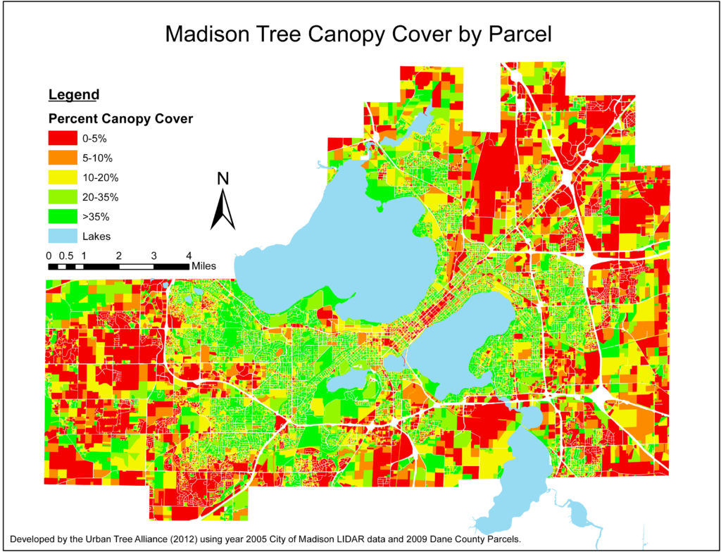
Presently the Madison area has about 18-25% canopy cover (depending on where one draws the boundary). We believe strongly in benefits of trees to urban areas and encourage community members to get involved with tree planting in their neighborhood or on their property.
The map below was developed by the Urban Tree Alliance in 2012 and used to guide the selection of the first Madison Canopy Project neighborhoods in 2014.